Community Corner
(MAP) Report Details Tornado's Track Across Minneapolis, Suburbs
It was an EF1 or EF2, the NWS said.


Here's an assessment of Sunday's tornado from the National Weather Service, released Monday night. A crew visited St. Louis Park, Golden Valey, Minneapolis, Fridley and other locations Monday to and prepare this report. (Note that in rating tornadoes, EF stands for Enhanced Fujita Scale.)
Also, check out the map to the right to see some of the many spots where the tornado caused damage. If you know of a spot we're missing, please tell us in the comments below.
Survey Team Assessment on the Northern Twin Cities Metro Tornado of Sunday Afternoon, May 22nd
Find out what's happening in Fridleywith free, real-time updates from Patch.
The tornado that hit north Minneapolis and other areas will be rated either as a strong EF1 or an EF2. There remain some uncertainties in rating the tornado that hit north Minneapolis, St. Louis Park, Golden Valley, Fridley and Mounds View and Blaine since some of the field information gathered still needs to be processed.
However it is safe to say that it will be rated as either a strong EF1 or possibly an EF2. The tornado was about 1/2 mile wide at its widest point. It was on the ground for 6 and one quarter miles in Hennepin County, plus an additional 8 miles across Anoka and Ramsey counties as the tornado went through parts of Fridley, Mounds view and Blaine.
Find out what's happening in Fridleywith free, real-time updates from Patch.
The initial touchdown in St. Louis Park was 3/4 of a mile south-southwest of the intersection of Interstate 394 and Highway 100 where two businesses sustained roof damage. The tornado moved northeast, crossing Highway 100 where it hit the first residences along Cedar Lake Road.
It then entered the southeast portion of Golden Valley, crossed Interstate 394 and headed for During this time it took a bit of a northward turn and began moving to the north-northeast.
The tornado moved across Wirth Lake and entered the City of Minneapolis between Glenwood Avenue and 16th Avenue.
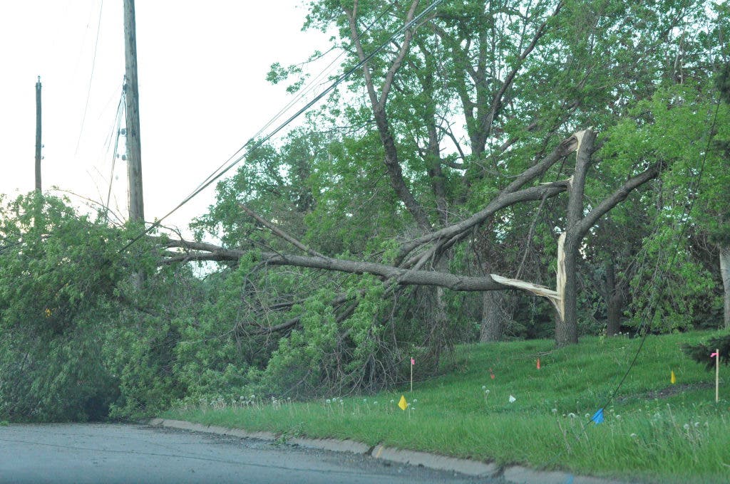
Up to this point, damage was EF0 with the vast majority of the damage being downed trees atop of building and vehicles.
As the tornado entered Minneapolis, it strengthened to EF1. The tornado headed for the hard-hit area around Lowry Avenue and Logan Avenue, then to 42nd Avenue and Lyndale Avenue.
It crossed the Mississippi River just north of the Camden Bridge and began causing damage in Anoka County.
It moved across the Minneapolis water intake facility. At the water treatment facility, a free standing storage garage was completely destroyed with numerous cottonwood trees on the grounds uprooted or having large limbs snapped off.
From the water facility the tornado tracked northeast to a large industrial facility where a large metal building on the grounds had parts of two walls ripped off and a large section of the roof blown off.
It then moved into the train yard where several train cars were tipped over. On the other side of the train yard more industrial facilities and warehouses sustained damage along Miami Street, the worst being a warehouse that lost part of its roofing.
The stronger EF1 or EF2 damage occurred in the area between Penn and Broadway and the area northeast of the Camden Bridge in the vicinity of the water plant and train yard facility. This is where additional information needs to be processed before a final rating can be assigned.
The tornado then moved across residential sections of Fridley where extensive tree damage was done northeast to the area of the Middle School.
The tornado then weakened as it continued northeast across the east side of Fridley to Spring Lake where it moved into the northwest side of Mounds View. Sporadic tree damage occurred during this time frame.
The last signs of damage were seen on the south side of the Blaine-Anoka County Airport where a few hangars received some minor exterior damage.
The tornado was on the ground for about 8 miles from Fridley to Blaine.
Editor's note: I changed the format from all capitals, corrected a few typos and made other minor changes to the original in the text above. The map is based on the NWS report as well as police scanner reports on Sunday, information from and , Patch site vistors and Facebook friends.
Get more local news delivered straight to your inbox. Sign up for free Patch newsletters and alerts.


