Community Corner
WATCH: The Twin Cities May 22, 2011, Tornado in 3D Radar Images
National Weather Service radar images show tornado as a column of red.

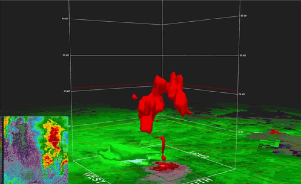
Here is a looping 3D radar image of the May 22, 2011, tornado that hit Minneapolis as well as Fridley, Golden Valley, St. Louis Park and other suburbs. The National Weather Service has this description:
A 3D look at the Minneapolis tornado from the Chanhassen radar. The "column of red" is a descending core of air moving away from the radar that can sometimes be seen when stronger tornadic storms are close to a radar (greens represent air moving toward and reds away from the radar). The first image where a column appears is when the storm was near I-394 and MN-100 (fourth image in loop), which is where the tornado touched down. This feature began to fall apart as it moved into Anoka county. This coincides with the tornado weakening as it moved through Fridley.
Find out what's happening in Fridleywith free, real-time updates from Patch.
Get more local news delivered straight to your inbox. Sign up for free Patch newsletters and alerts.


